Unique Properties
Looking for your own outdoor escape in Kentucky?
Discover 311 acres in Manchester, Kentucky, listed at $233,900. Featuring multiple trails, a secluded setting, and a rear boundary adjoining Daniel Boone National Forest, this property offers space for hunting and outdoor recreation.

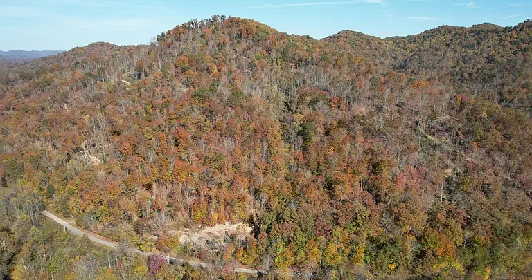
311 Acres with Trails and a National Forest Boundary in Manchester, Kentucky
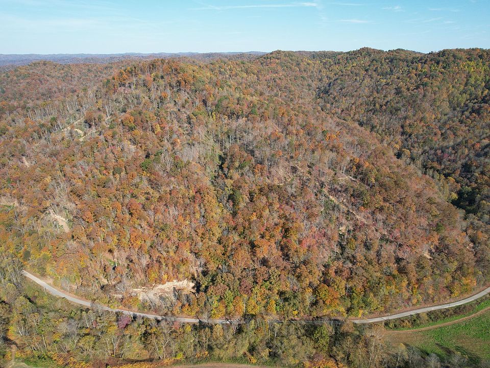
A large tract of land near Manchester, Kentucky, offers room to explore, a secluded setting, and an established network of trails. Advertised at $233,900 in the supplied listing, the property at 99 Beech Creek Road #Mid-12 encompasses approximately 311 acres and is presented as an opportunity for private hunting and outdoor recreation.
The listing highlights access from Beech Creek Road, proximity to Highway 11, and a location approximately two miles from Governor’s Campground. It also states that the back of the property connects with Daniel Boone National Forest, making that boundary an important part of the offering.
For someone interested in owning a substantial piece of rural land, the appeal begins with its scale. However, understanding the property also means examining its trails, terrain, boundaries, access arrangements, and utility information. Together, these details help explain how the acreage might fit a prospective buyer’s plans.
A Substantial Land Offering Near Manchester
The property is located in the Manchester area of Kentucky, within the 40962 ZIP code. Its listed address is 99 Beech Creek Road #Mid-12, and the marketing description identifies the acreage as “311 acres more or less.”
That wording is worth preserving. The listing presents a substantial tract, but the exact boundaries and acreage should be understood through the available deed, survey, and other property records.
The size is a defining feature because it shifts attention beyond a single homesite or small recreational clearing. A prospective owner would be evaluating a broader landscape, including the routes through it, the relationship between different sections, and the time needed to become familiar with the land.
Private Hunting Land as a Central Feature
Private hunting land is one of the main features emphasized in the description. The acreage and secluded setting explain why hunting forms a central part of the property’s presentation.
For someone interested in this use, owning a large tract provides a different experience from visiting a small parcel. It allows the owner to learn the property over time, observe conditions in different areas, and plan activities around its layout.
The supplied listing does not identify wildlife species, population estimates, established hunting stands, or prior hunting results. Those details should not be assumed.
A property visit would help prospective buyers evaluate the setting for themselves. Confirming boundaries and understanding applicable hunting requirements would also be essential before putting any plans into practice.
Multiple Trails Already on Site
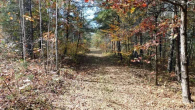
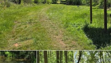
The listing states that multiple trails are present throughout the property. On a tract of approximately 311 acres, these routes are a significant practical feature.
Trails can provide a framework for exploring the land, helping visitors move between areas and develop a clearer understanding of the property’s overall arrangement. They may also make repeat visits more purposeful by offering familiar routes through otherwise extensive surroundings.
The description does not specify trail mileage, widths, surfaces, or maintenance conditions. It also does not establish whether particular routes are suitable for vehicles, equipment, or walking only.
Those distinctions are best assessed on site. Following representative sections would help a prospective buyer understand how the trail network functions and which parts of the acreage it reaches.
Exploring the Land Through Its Existing Routes
The value of an internal trail network lies partly in the way it connects the landscape. A route may lead toward a boundary, pass through wooded sections, or provide a way to examine areas that are less visible from the entrance.
For a first visit, the trails offer a useful starting point. Rather than trying to understand the entire tract at once, visitors can work through it in sections and compare what they see with available mapping.
This approach also helps reveal questions that photographs may leave unanswered. Changes in grade, drainage, footing, and vegetation become easier to assess when moving through the property.
The existing routes are therefore both an advertised feature and a tool for evaluating the rest of the land.
Access from Beech Creek Road
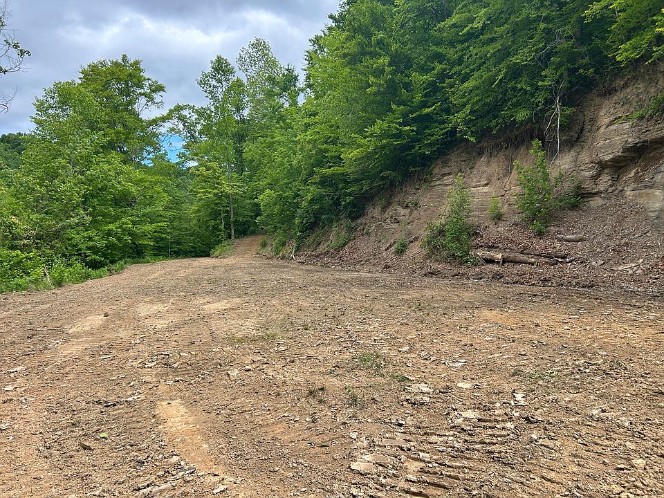
According to the marketing description, the property has an easy access point from Beech Creek Road. That connection is important because the approach to a rural tract affects how practical it is to visit and use.
The listing does not provide a detailed entrance plan, road frontage measurement, or description of any gates or internal road construction. It also does not explain how the approach performs under different weather conditions.
Prospective buyers should examine the entrance and confirm the relevant access documentation. The location of the access point should also be compared with the parcel boundaries.
Understanding the entrance is about more than reaching the property once. It helps establish whether the approach suits the vehicles, visit frequency, and activities a future owner has in mind.
Seclusion with Connections to Nearby Roads
The description presents the property as secluded while also noting its convenience to Highway 11 and Beech Creek Road.
These qualities serve different purposes. Seclusion contributes to the experience of spending time on the acreage, while nearby road connections influence the practical side of getting there.
The listing does not provide travel times to Manchester’s services, specific businesses, or other destinations. Those details would depend on the route and the buyer’s starting point.
For someone considering regular visits, it would be useful to drive the approach and assess how it fits their routine. A property can offer extensive outdoor space, but its long-term usefulness also depends on how comfortably the owner can reach it.
A Boundary Connecting with Daniel Boone National Forest
One of the most distinctive statements in the supplied listing is that the property connects with Daniel Boone National Forest on its back side.
This relationship gives the rear boundary particular importance during the evaluation process. Prospective buyers should locate it on available maps and confirm how the private parcel meets the neighboring forest land.
The statement should not be expanded into a promise of direct access to a particular public trail, unrestricted vehicle travel, or permission for every recreational activity. The listing does not establish those details.
Instead, the national forest connection is a specific location feature to investigate. Understanding where that boundary lies and which rules apply beyond it would help a buyer form an accurate picture of the surrounding landscape.
Rural, Woodland, and Mountain Views
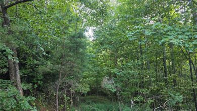
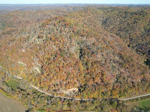
The property facts identify rural, trees-and-woods, and mountain views. These descriptions contribute to the outdoor character of the offering.
On a large tract, the outlook may differ from one location to another. Some sections may feel enclosed by trees, while others may provide a broader view of the surrounding terrain.
The supplied information does not identify particular viewpoints or describe the outlook from every part of the property. It also does not state that there are cleared observation areas.
Exploring the trails and changes in elevation would help visitors understand how the listed views appear on site. For someone who enjoys walking, observing the landscape, or outdoor photography, that variation may be part of the attraction.
Room for a Personal Outdoor Retreat
The marketing description refers to the land as a private hunting property or outdoor playground. That language points toward recreational use rather than an existing residential setup.
A future owner might be drawn to the opportunity to spend time walking familiar routes, exploring different sections, or simply enjoying a large rural setting. The experience would depend on the land’s actual conditions and the activities permitted there.
The listing does not describe installed recreational facilities, picnic shelters, designated campsites, or equipment included in the sale. Those features should not be added to the property description.
Its recreational appeal rests on what is stated: substantial acreage, multiple trails, a secluded setting, and connections to surrounding roads and forest land.
Understanding the Farm Classification
The property is categorized as a farm in the supplied listing. However, the accompanying description focuses on hunting, trails, privacy, and outdoor recreation.
No cultivated acreage, pasture measurements, livestock facilities, barns, fencing, or agricultural production records are provided. The classification alone should therefore not be treated as proof of a working agricultural operation.
Someone interested in farming would need to evaluate the land according to that specific purpose. Terrain, soils, access, water arrangements, and existing improvements would all require closer examination.
Keeping the classification separate from the documented features helps maintain an accurate description. This is a large rural tract, but the supplied information does not establish every use that might be associated with the word “farm.”
No Residence or Interior Space Is Described
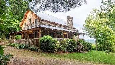
The listing records zero bathrooms and a total structure area of zero. It does not identify a residence, cabin, or other building.
As presented, this offering centers on the land itself. A buyer should not expect overnight accommodation or household facilities based on the supplied description.
This distinction is especially relevant for people imagining weekend stays or future construction. Those plans involve questions beyond the features currently listed.
The absence of a described residence does not determine whether a future project is possible. It means that any such project would need its own investigation, including the suitability of the land and the requirements associated with the proposed use.
Public Water Is Listed in the Property Facts
The utilities section identifies water as public. That is useful information, but the excerpt does not explain the precise arrangement.
It does not confirm whether there is an installed meter, an active account, a service line extending into the property, or a particular connection point. Those are separate details that a prospective buyer should clarify.
The supplied listing also does not describe electricity, sewer service, or an existing septic system. Missing information should remain an open question rather than being filled in with assumptions.
Anyone considering improvements would benefit from confirming utility locations and current service conditions early in their evaluation. Doing so would provide a more realistic understanding of what infrastructure is already present.
Price and Parcel Identification
The supplied asking price is $233,900 for approximately 311 acres. The listing identifies the parcel number as 1120000012.00.
That parcel identifier provides a useful reference when reviewing available property records, maps, and boundary information. It helps ensure that documents being examined relate to the tract described in the advertisement.
The listing excerpt does not include an annual property tax amount or a detailed schedule of ownership expenses. Those figures would need to be obtained separately if a buyer is considering the ongoing cost of ownership.
The price is therefore one part of the evaluation. Access, documented acreage, terrain, boundaries, utilities, and the condition of the trails all contribute to understanding the offering as a whole.
Making a Property Visit More Informative
A visit to a tract of this size is more useful when guided by specific questions. The entrance, representative trail sections, boundary locations, and areas associated with the advertised views are natural starting points.
Available maps can help visitors connect what they see on the ground with the property’s overall shape. They can also help distinguish the private acreage from adjoining land.
Because the tract is extensive, a short visit may not reveal every section. Prospective buyers should consider whether additional time or professional assistance is needed to understand the features most relevant to their plans.
The aim is to move from a broad impression of “large recreational acreage” to a clear understanding of this particular property.
A Large Kentucky Tract with Trails and a Distinctive Setting
This Beech Creek Road offering combines approximately 311 acres with multiple trails, a secluded rural setting, and a stated rear boundary connection with Daniel Boone National Forest. Access from Beech Creek Road and proximity to Highway 11 add practical context to its outdoor appeal.
The supplied description presents the tract primarily as private hunting and recreational land. It does not describe a residence, detailed agricultural improvements, or a complete utility setup.
For a prospective buyer seeking room to explore near Manchester, the property offers several concrete features to investigate. Its suitability will ultimately depend on how the documented boundaries, access, terrain, and existing trails match the buyer’s intended use of the land.



From Zillow