Affordable Homes
Unrestricted Land with 80 Acres in Strunk, Kentucky
Unrestricted Land with 80 Acres in Strunk, Kentucky

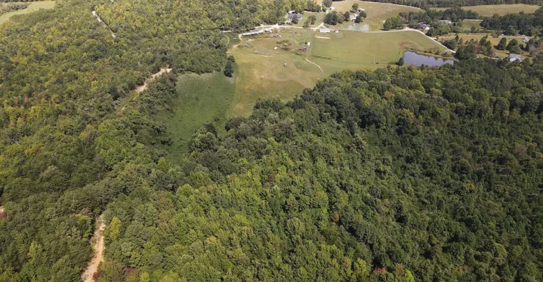
80 Acres of Wooded Land for Sale in Strunk, Kentucky
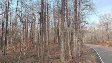
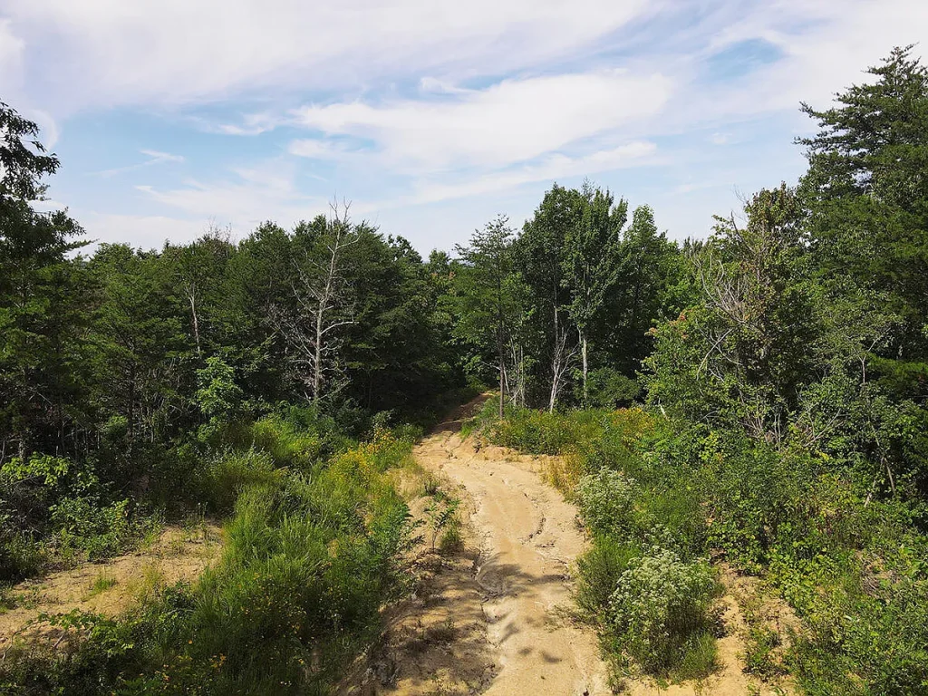
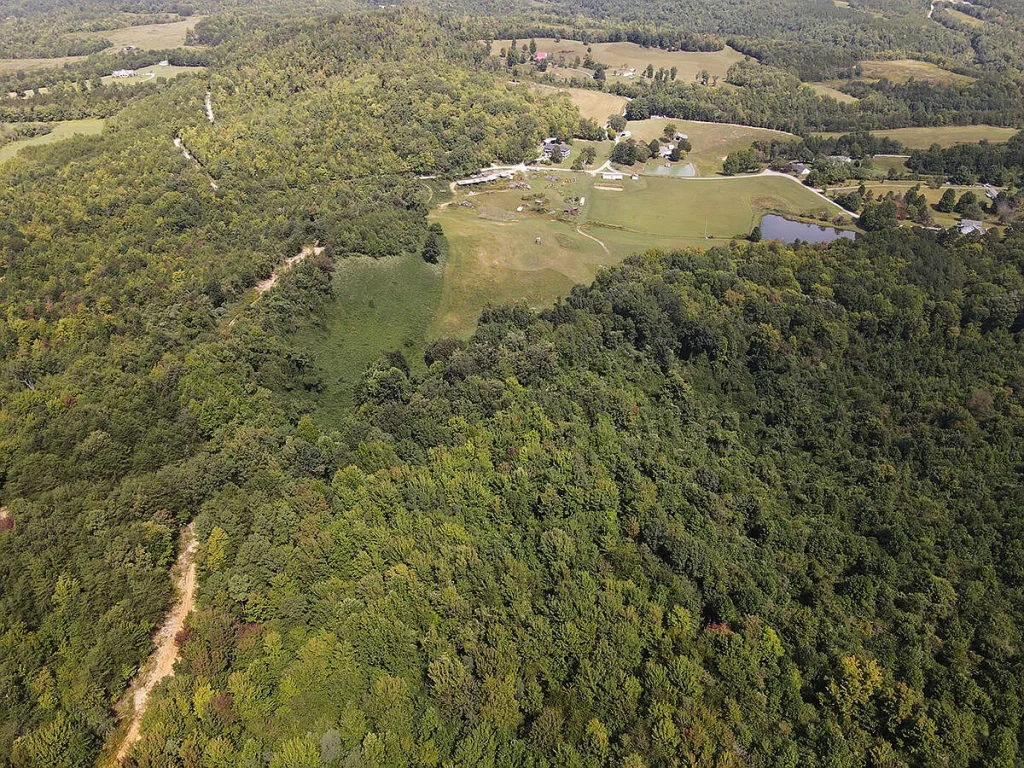
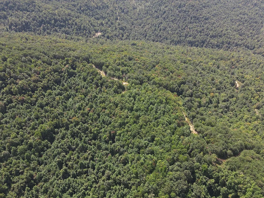
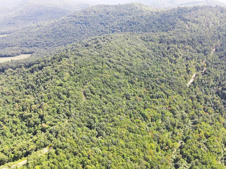
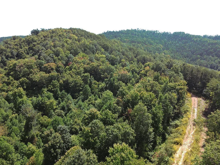
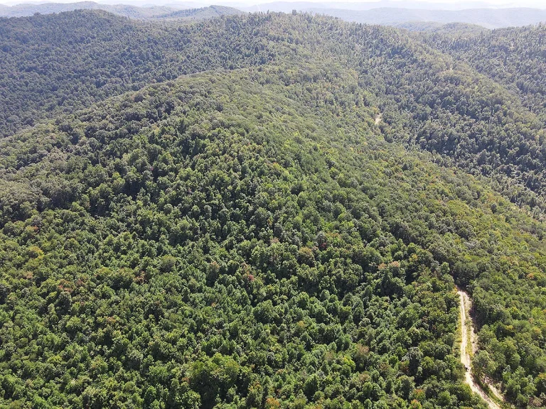
This 80-acre tract in Strunk, Kentucky, offers room to explore the woods, spend weekends outdoors, and develop a plan for the land over time. Located in southern McCreary County, the property has a mix of rolling slopes, hills, and gentler terrain. The timber was harvested approximately 13 to 15 years ago, and wooded cover has grown back across the acreage. There is no house or other building on the property.
The mix of terrain gives prospective buyers several reasons to walk the land before deciding how they would use it. A gentler section might catch your attention as a place to set up camp or evaluate for a future project. Higher ground might be more interesting for walking, photography, or exploring potential views. The listing reports that electricity and water are available at the property line, giving buyers who want utility service a starting point for inquiries.
Property Details at a Glance
| Feature | Listing details |
|---|---|
| Location | Strunk, Kentucky, in southern McCreary County |
| Lot size | 80 acres |
| Terrain | Wooded, rolling, gently sloping in places, and hilly |
| Existing structures | None |
| Zoning and restrictions | Listed as R-1 with no restrictions |
| Electricity | Listed as available at the property line |
| Water | Listed as available at the property line |
| Timber history | Harvested approximately 13 to 15 years ago |
| Parcel number | 1940000013.00 |
What the Rolling Terrain Looks Like on a Property Tour
Eighty acres gives you plenty of ground to cover, and a walk through one section may feel quite different from a walk through another. The listing describes both hilly and gently sloping terrain. Start with the route you would take from your arrival point and see how quickly the grade changes. Somewhere that looks close on a map may take longer to reach when the route goes uphill or passes through thick regrowth.
If you are considering a future campsite or a spot for a project, spend a few minutes standing in each area that catches your eye. Look uphill to see where runoff might come from after rain. Look back toward the route you walked in on and imagine carrying water, tools, or camping gear. A spot that takes five minutes to reach empty-handed may feel different at the end of a weekend when you have several trips to make.
The steeper parts can be interesting for their own reasons. They may offer a more substantial walk or give you a chance to see how different parts of the property fit together. The listing mentions views from the land, with some locations potentially offering more open sightlines after clearing. If views are a priority, ask the agent to show you those areas so you can see what is visible today and how the surrounding trees frame the landscape.
Wooded Regrowth After the Timber Harvest
The property’s timber history is worth keeping in mind when you tour. The listing places the harvest approximately 13 to 15 years ago and describes the land as being in a period of regrowth. As you walk, notice which areas have enough space between trees to pass through comfortably and which sections would take more work to cross or clear. The amount of effort can vary considerably over a short distance.
If your first goal is to explore the land, you may only need a footpath connecting a few places you want to visit. A wider route for moving equipment or creating a larger clearing would be a different project. Pay attention to where a route could follow the shape of the ground and where additional work might be needed. A simple sketch of the areas you visit can help you remember which routes looked practical and which ones you would want to examine again.
The tree cover can also be part of what you want to keep. If you find a spot with shade or like the way the woods screen one area from another, walk around it before deciding where a clearing would go. A small opening might give you the space you need while preserving the wooded setting that brought you to the property in the first place.
Hiking, Camping, and Wildlife on the Acreage
For a buyer interested in recreation, a weekend here could start with a walk, a pair of binoculars, or a tent. The varied terrain gives you a reason to explore the property in sections. You might spend one visit getting familiar with the gentler ground near your arrival point and use another to see where the hills take you. If you eventually want a regular walking route, look for places where the terrain allows you to loop back without retracing the entire trip.
If camping appeals to you, compare a few spots before settling on a favorite. One might be easy to carry gear to, while another might have better shade or feel more sheltered. Think about when you would typically arrive. A site that takes a while to reach may be a pleasant choice on a Saturday morning, while somewhere closer to your arrival point may make more sense if you usually come after work.
The listing reports wildlife activity in the area, including whitetail deer and turkey. If watching wildlife, taking photos, or evaluating the property for hunting is part of your interest, give yourself time to slow down during the tour. Look at where thicker woods meet more open ground and note which sections you can reach comfortably. Ask about the surveyed boundaries if you want to understand how the terrain you see relates to the parcel on a map.
Electricity and Water Availability
The listing states that electricity and water are available at the property line and that neither service currently extends onto the acreage. If utility access matters to your plans, ask where the connection points are in relation to the area you would use. A campsite, a small clearing, and a potential future homesite may sit at very different distances from the same connection point.
It helps to bring a parcel map and mark any locations you are considering. With those places identified, you can ask the utility providers about the work involved in serving each one and request a cost estimate based on the location. The length of the route, the shape of the ground, and where you want service can all affect how you compare the options.
Your plans may also change the order in which you want to do things. For occasional walks and day trips, your first focus might be getting familiar with the boundaries and finding a route you enjoy. If you already have a specific future use in mind, the location of the utility connections may influence which part of the property you look at first. Either way, the walkthrough gives you more specific questions to bring to the agent or service providers.
Evaluating the Property for a Future Project
The listing describes the zoning as R-1 with no restrictions. If your interest depends on a specific use, ask the listing agent for the documents behind that description and confirm your plans with the relevant local office. The parcel number, 1940000013.00, gives you a reference to use when asking about this particular tract.
If you have a future home or cabin in mind, walk any area you are considering and picture the full approach from your arrival point. The area where a structure might sit is one part of the decision. You may also want to leave room to bring in materials, move around the site, or keep trees for shade. Consider which way you would want to face and what the view looks like from that position at ground level.
Some buyers may want to enjoy the acreage for a few seasons before making decisions about clearing or construction. Walking the same route at different times of year could help you see when foliage opens up a view, where you like to spend time, and how the ground feels after wet weather. Over time, those visits can give you a better sense of which improvements would actually make the property easier or more enjoyable to use.
Strunk and the Southern McCreary County Setting
Strunk is in southern McCreary County, near the Big South Fork National River and Recreation Area in the Cumberland Plateau region. If you are coming from outside the area, a property visit is a chance to see how the tract fits into the kind of weekend you have in mind. You could spend part of the day walking the acreage and use the rest to get familiar with the surrounding area.
Think about the trips you would actually make. If you plan to visit often, pay attention to the drive and how much daylight you would typically have when you arrive. If you expect to bring friends or family along, consider which part of the property you would show them first and whether you would want a short walk through the woods or a longer outing over the hills. Those everyday details help you decide whether the land suits the way you want to spend your time.
What to Ask the Listing Agent Before a Showing
Ask whether a survey, parcel map, or recent aerial image is available. Having a map before you arrive makes it easier to follow the tour and connect what you see on the ground to the overall shape of the property. If the listing photos show a view, an open section, or a gentler slope that caught your attention, ask the agent to point out where the photo was taken.
A few questions can help you get more out of the visit.
- Where do visitors enter the property, and what documents describe that access?
- Are any boundaries or corners marked on the ground?
- Where are the reported electricity and water connection points?
- Which sections have gentler slopes, and where are the views mentioned in the listing?
- Are any paths or routes currently usable for walking the tract?
- What documents are available for the listed zoning and restrictions?
If you have time on the tour, see one section you could use right away and one you would want to come back to explore. Comparing the two can help you judge how much of the property’s appeal comes from what you can already enjoy and how much depends on work you would want to take on.
Schedule a Visit to the 80 Acres in Strunk
This wooded tract is worth walking if you are looking for Kentucky acreage with varied terrain and room for outdoor recreation or a future project. The gentler slopes, hills, and regrowth are easier to understand in person, particularly if you are deciding where you would camp, which parts you would explore, or how much clearing your plans might involve.
For current pricing, availability, and showing information, contact the listing agent through the Zillow link below the property photos.
Listed on Zillow.